
Murphy Neighbors Block Sources
Each public source supplies a different part of a block-level picture. The county map is the discovery layer. Its parcel polygons, address points, subdivisions, abstracts, and boundaries show where to look next. The Collin Central Appraisal District account provides the owner/file-as name, situs and mailing fields, identifiers, legal description, exemptions, and tax-year context for one parcel at a time. County Clerk instruments provide a date and party role. None of those records alone proves who currently lives next door.
| Source | What It Shows About a Block | Access |
|---|---|---|
| GIS Appraisal District parcel layer | Adjacent parcel shapes, address points, subdivisions, abstracts, and boundary overlays | Public map with Identify, Query, and Export operations |
| CCAD owner search | Owner/file-as, mailing and situs, identifiers, legal description, exemptions, and tax-year context | Free public portal; data updates nightly |
| Clerk plat and deed index | Lot, block, subdivision, recorded parties, and instrument dates | Public index; image and copy limits apply |
| County voter list | Registered or mailing addresses, precincts, districts, and participation flags | Purchased Excel file with legal and privacy limits |
| Community pages | Association boundary, board, document, or committee route | Public pages; household rosters remain private |
A road, creek, association common land, vacant tract, or municipal parcel may be physically adjacent without representing a neighboring household. Map proximity is not even proof of a shared block, because a parcel can extend behind another street.
Murphy Parcel IDs Before Names
Begin in the Collin County Interactive Map, zoom to the known address, and activate the Appraisal District and Address Points layers. Click the target parcel and write down its property or geographic identifier. Also record its legal description and subdivision lot or block where present. These are steadier matching keys than a casual neighborhood label or a map pin.
The Appraisal District map service documents parcel, subdivision, abstract, ZIP, and boundary layers, plus Identify and Query functions. A map outline is useful for discovery, not for inferring a name. Pivot from each selected polygon to its CCAD account before drawing a conclusion about a Murphy neighbors search.
School, election, flood, utility, transportation, and service-area layers provide local context, but those overlays answer geography questions rather than ownership or occupancy. The map also supports Export Map, yet an exported view remains a visual aid. The CCAD account and recorded instrument are the places to confirm the owner and legal-description facts behind a selected shape.
Address → target parcel/geographic ID → adjoining polygons → CCAD account → Clerk plat or deed when the legal description needs confirmation.
Map Murphy Neighbors by Parcel
After recording the target parcel, click each polygon that actually touches it. Compare the legal description, subdivision, lot, and block. Then open the related CCAD account and keep its situs address separate from the owner mailing address. An exemption flag may offer owner-occupancy context, but it is not a live statement that a person occupies the parcel. This method identifies recorded parcel relationships, not a complete household roster.
- Search the known Murphy address in the GIS map and select the target polygon.
- Record the parcel or geographic ID, legal description, subdivision, lot, and block.
- Click each adjoining polygon, excluding roads, drainage, common areas, vacant land, and municipal tracts when they are not household parcels.
- Use CCAD to check each selected parcel’s owner/file-as name, mailing and situs fields, and identifiers.
- Use a plat or deed index only when the layout, lot/block, or recorded party needs confirmation.
For a longer run of addresses along a named road, the Murphy by-street directory follows the broader address chain rather than the immediate-block method.
Murphy Plats and Deed Context
The Collin County Official Public Records search provides the recorded-document index. A plat can link subdivision layout, lot, and block to the legal description on the appraisal account. A deed can identify grantor and grantee, document type, date, and the legal description used for the transfer. Search the parcel’s legal description as well as names, because an address string can be incomplete or change form.
Free document images may carry an unofficial watermark. The county’s public-search instructions describe registration, cart, and payment for clean copies. Its historical route covers 1843 through 1975, but that does not mean every image appears in the same modern search screen. Easements, liens, releases, and foreclosures can name parties without identifying an occupant.
For a subdivision question, compare the plat’s lot and block with the CCAD legal description before using a party name from an instrument. A recorded transfer can involve only an interest in land, a trust, or an entity. Date, document type, and matching legal description are the safeguards that keep a physical adjacency search from becoming a guess about Murphy neighbors.
- Parcel
- A defined piece of land represented in the appraisal and map records.
- Plat
- A recorded map that lays out a subdivision, lots, blocks, easements, and related references.
- Situs
- The physical property location, which differs from the mailing address on an appraisal account.
Murphy Neighbor Voter File Limits
The free Collin voter search takes a first name, last name, and date of birth. It does not offer a public street-browse route. The county’s purchased voter list is the documented channel that can contain registered and mailing addresses, precinct and district fields, registration details, and election-history flags. It is delivered as an Excel file and includes Active and Suspense voters.
The county’s Election Store describes a price of $27.06 plus a $1 convenience fee. Texas Election Code §18.009 restricts commercial advertising or promotion using voter lists. Phone numbers, email addresses, Social Security numbers, driver-license numbers, and DPS identification numbers are not public voter-list fields. Protected voters can have substitute or redacted addresses, and participation history does not disclose ballot choices.
Note: A voter-list result can be a registration record, not a complete answer about who lives in a Murphy household today.
Murphy Neighbor Community Routes
Community pages may help identify the right association contact or public documents, but they do not create a public list of Murphy neighbors. The Ranch and Maxwell Creek North each have a documented public-facing route. The city’s CivicWeb portal makes certain boards, agendas, minutes, and participant documents public, yet meeting participation is not a household directory.
| The Ranch HOA | Public FAQ, board, and document route; its member portal does not provide a public member-name directory. |
|---|---|
| Maxwell Creek North HOA | Public landing and registration route with landscaping, social, pool, and crime watch/safety committee descriptions; roster access is private. |
| Murphy CivicWeb | Public boards and meeting documents; it is not a household roster. |
The Ranch HOA public website is shown below as an example of a community contact route, not a source for a resident list.
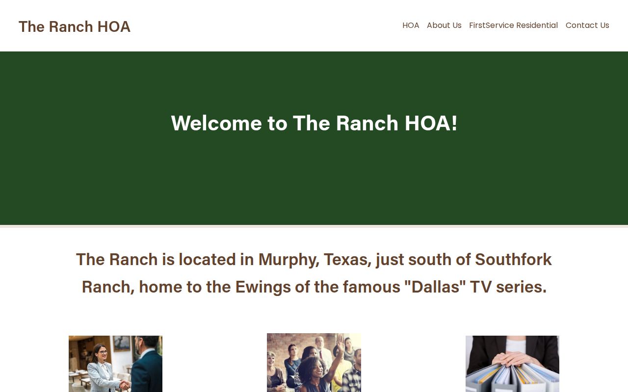
The public site distinguishes board, FAQ, document, and member-portal functions. That boundary matters: a community page can point to an association process while member rosters remain behind login or are not publicly located.
Murphy Neighbors City Address Records
Murphy permit material can connect an address to a subdivision, lot, block, applicant, owner or agent role, contractor category, and work or inspection status. The online permitting route is intended for registered contractors and does not promise a public historical address index. A named applicant, agent, owner, or contractor is not proof of a household member.
For code and police material, use the city’s records-request route or the police public-information form for an existing, specified record. Texas Public Information Act requests do not require the city to create a new block list. Names and details can be redacted for juvenile, victim, medical, pending-investigation, plate, body-camera, or other protected information.
City permit applications may include an address, subdivision, lot, block, construction category, and several role fields. They are dated property evidence, not proof that an applicant, owner, agent, or contractor lives at the location. Where a record is not exposed online, ask for that individual existing permit or address file, rather than a new compilation of nearby people.
Murphy Neighbor Records Compared
Official sources and commercial neighbor-lookup categories serve different purposes. The official route names the custodian, date, field, and access boundary, making it possible to check the underlying parcel or recording. Commercial categories can combine marketing data, public filings, and address histories, but they may merge same-name people or retain stale information. They do not make private household layers public.
| Official role record | Commercial neighbor category | Responsible use |
|---|---|---|
| GIS, CCAD, Clerk, or election record with a custodian and date | Compiled address-history and marketing-data profile | Verify each claim with the named government or association source |
| Parcel owner, party, registrant, applicant, or board role | Suggested household association | Do not convert a role into a claim of current occupancy |
| Public page with stated access limits | Changing profile and opt-out practices | Protect sensitive information and use the minimum needed detail |
Murphy Neighbor Privacy Limits
Renters, children, guests, utility customers, delivery recipients, protected voters, sealed cases, and private association rosters are not a public block directory. Texas Address Confidentiality Program participants and protected voters may have a substitute or suppressed address. DMV data is not a public address route. When a block record is missing, do not try to reconstruct private information from unrelated sources.
Use an address, parcel, record type, and date when seeking an existing public record. If a response contains redactions, those are part of the lawful boundary, not an invitation to search around them. The most reliable conclusion may simply be that the public record identifies an owner or a parcel relationship, not the person who lives there.
Lawful use. Use Murphy neighbors records for personal, lawful research and community context. Texas Penal Code §§42.072 and 42.07 address stalking and harassment; never use records to watch, threaten, intimidate, or harm anyone.