
Murphy Street Directory Walkthrough
Begin a Murphy street directory search with a known address in the Collin Central Appraisal District search. Enter the street number and street name. When that form does not return a useful match, retry a simple street name without a prefix, suffix, or unit number. Save the property ID, geographic ID, owner or file-as name, situs address, mailing address, legal description, subdivision, lot, block, tax year, values, and exemption fields that appear on the parcel card. CCAD identifies its data as research material and directs users to verify legal descriptions and acreage before relying on them for a legal document.
Then use the geographic ID or legal description to keep the trail tied to one parcel. A street is a useful starting point, but it can contain lots, shared features, and addresses that do not represent a household. The following sequence keeps a name, property, and document from being mixed together.
- Search the address in CCAD and record the parcel identifiers and legal description.
- Open the county map, locate the address point, and click the parcel rather than assuming the visible outline supplies a name.
- Use the current owner as a grantee or general search term in the County Clerk index, then compare the recorded date and legal description.
- Check the matching subdivision plat for lot and block context before treating similar street names as the same property.
- Use voter, permit, and historical directory material only as separate dated evidence, not as a complete household list.
Note: A complete street roster is not promised by any one public source in Murphy.
Murphy CCAD Address Fields
CCAD has current By Owner and Advanced tabs. Its legacy instructions add useful search conventions: owner names are filed Last First and an asterisk can act as a wildcard. A name search can help after an address search, but it should not replace the parcel identifiers. The table groups the actual address-oriented controls for a Murphy address search. All are optional in the rendered form unless noted otherwise.
| CCAD field | How it is used | Format or caution |
|---|---|---|
| Owner Name | Find an account after a parcel lead | Last Name First Name; legacy search accepts *. |
| Street Number and Street Name | Start an address search | Use a simple street name if a full version fails. |
| Property, Geographic, or Owner ID | Pin the result to one account | Geographic ID is alphanumeric; legacy instructions allow omitted dashes. |
| Property Type and Tax Year | Limit account context | Property type and tax-year lists are form controls. |
| Doing Business As | Find a public account business name | Legacy instructions describe wildcard use. |
| Abstract, Subdivision, Condo, Neighborhood | Match land description and development context | Searchable lists or controls, not proof of occupancy. |
| City and School District | Apply legacy geographic filters | Legacy interface fields; boundaries can overlap differently. |
| Legal Description | Match a document to the parcel | Use the wording to distinguish similar street references. |
The city field and a mailing address are not a substitute for the situs or the legal description. CCAD also offers property type, account status, sort controls, protest dates, board members, and formal or hearing dates. Those advanced fields may narrow an appraisal record, but they do not establish who currently occupies an address.
Murphy Street Parcel Keys
Three labels often appear to describe the same place but do different work. The physical parcel anchors the address search. The mailing address tells CCAD where notices go. The legal description connects the parcel to a subdivision plat and a recorded instrument when a street string changes, is abbreviated, or is shared by nearby places.
- Parcel
- A defined piece of land in the appraisal and map systems, commonly tracked with property and geographic IDs.
- Situs address
- The physical location of the parcel. It is distinct from the address used for appraisal notices.
- Plat
- A recorded subdivision drawing that can show lot, block, easement, and layout information.
- Criss-cross directory
- An address-to-name style directory. No dedicated Murphy run was confirmed in the research.
A mailing address may be outside Murphy or belong to a trust, business, tax agent, or prior owner. An exemption field can provide context, but it is not a live statement of residence. Use careful terms such as parcel owner of record and mailing address on the appraisal account.
Murphy Street GIS Steps
The Collin County Appraisal District map service supplies the visual part of a street search. Turn on Address Points and the Appraisal District parcel layer, zoom to the address, and use Identify on the parcel. Subdivision and Abstracts layers help test a legal description. ZIP, school, election, flood, transportation, utility, and boundary layers add context, while Query, Find, and Export are documented service operations. Copy the parcel or geographic identifier and return to CCAD for owner-account evidence.
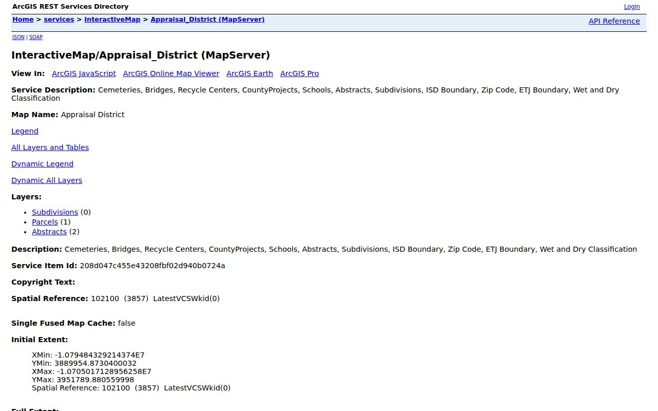
The map is a discovery surface, not a name source by itself. A parcel polygon may cover a road feature, common area, vacant tract, or land that reaches another street. The CCAD account and the recorded document are the checks that keep the map view from becoming an unsupported identity claim.
Murphy Street Plat Match
For a subdivision address, open the County Clerk portal and choose Property Records, then Plats. Search with the subdivision name and match the plat's lot and block to the CCAD legal description. This route is especially useful when the mailing city, ZIP, or a casual neighborhood label points in a different direction. A plat defines land layout and recording context. It does not list people who live there.
The City of Murphy subdivision-map page is another local way to orient an address before making the parcel-to-plat match.
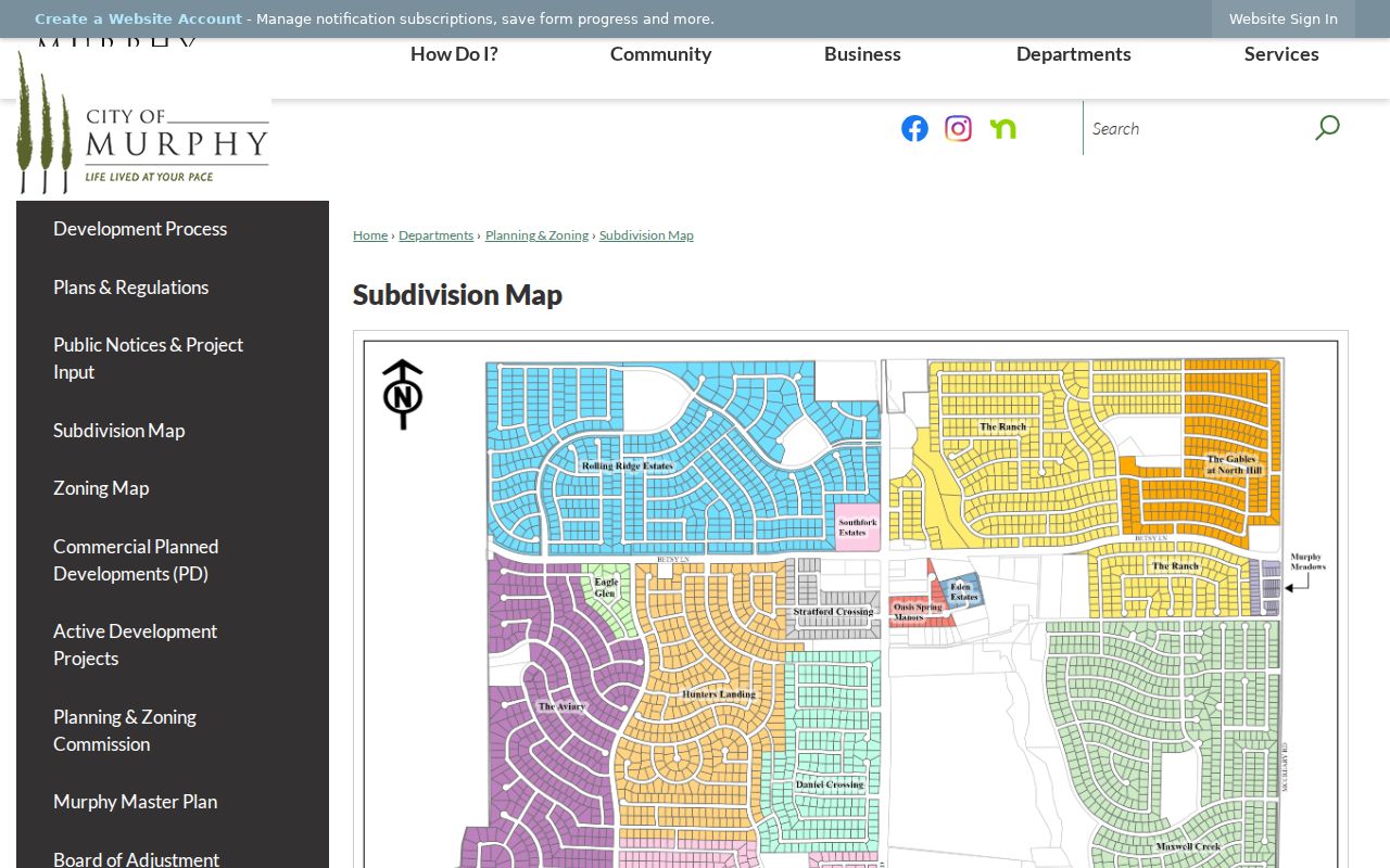
Use the city map to recognize a subdivision pattern, then verify the lot and block in the clerk's recorded plat and the appraisal account. That sequence is stronger than a ZIP-only or street-name-only match.
Murphy Street Deed Trail
The Collin County Clerk Official Public Records index is the transaction layer for an address search. Search the current owner as a grantee or a general term, narrow by date or property category, sort by recorded date, and compare the legal description with CCAD. The candidate purchase document identifies a seller or grantor. Searching that seller as a grantor in earlier records can continue the chain. Deeds, liens, releases, foreclosures, and easements can all name parties, but only a deed matching the parcel should be read as a transfer lead.
Insider tip. County instructions favor three checks together: CCAD's legal description, the recording date, and the seller's name. A name match alone is weak when a party held only an interest or signed an unrelated instrument.
The Clerk index has a free, unofficial-watermarked image route. A clean copy requires an account, cart, and payment. For older material, the documented navigation is Other Services, then Historical Records for 1843 through 1975. The land-record counter is also available at 2300 Bloomdale Road, Suite 2106, McKinney, at 972-548-4185 when an online path does not supply the needed record.
The official Clerk search displays the same starting controls used for a grantor, grantee, document-type, subdivision, date-range, and OCR search.
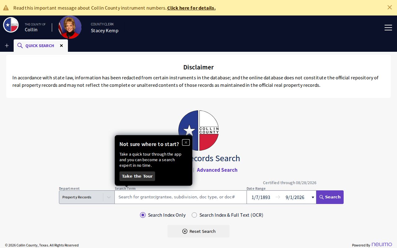
Document images and index entries are evidence of a recorded event. They are not proof that an indexed party lived at the parcel on the date of a later search.
Murphy Street Records at One Address
Address-keyed sources overlap, but each answers a narrower question. Combining them can clarify whether an address, parcel, subdivision, and recorded document belong together. It cannot turn separate role-based records into a complete current-resident list.
| Address record | Custodian | Useful evidence | Access path |
|---|---|---|---|
| Parcel card | Collin CAD | Owner/file-as, situs and mailing addresses, IDs, values, exemptions | Free CCAD web search; data updates nightly. |
| Parcel map | Collin County GIS | Parcel shapes, address points, subdivisions, abstracts, boundary overlays | Public map, Identify, Query, and Export tools. |
| Deed or lien index | Collin County Clerk | Named parties, dates, instrument type, legal-description trail | Free index and watermarked image; paid clean copy. |
| Plat | Collin County Clerk | Subdivision, lot, block, easement, layout | Property Records to Plats, then image or copy route. |
| Voter registration list | Collin Elections | Registered or mailing address, districts, status, history fields | Regulated paid list request; protected-voter limits apply. |
| Permit record | City of Murphy | Property, lot/block, work, and listed applicant roles | Contractor portal or city records route. |
Tax accounts are maintained separately by the County Tax Assessor-Collector, while appraisal data comes from CCAD. Keep that division in mind when a bill or payment question accompanies a parcel search.
Murphy Street Voter Limits
The free Collin voter lookup asks for First Name, Last Name, and Date of Birth. It is not a street-browse tool. A result is registration evidence, not a promise that a person currently lives at an address. County research did not confirm a ZIP field, address field, or full result layout in the public form without a qualifying query.
The voter-registration list is the documented broader access path. The Election Store or voterregistration@collincountytx.gov can provide an Excel list for $27.06 plus a $1 convenience fee. It can include ordinary registered and mailing addresses, precincts, districts, registration dates, and election-history fields, subject to protected-voter restrictions. It contains no vote choices, phone numbers, or email addresses. Election Code 18.009 prohibits commercial advertising or promoting products and services from a voter list.
Murphy Street Permit Trail
Murphy Building Inspections Online Permitting is a dated address layer, not a household roll. It is designed for registered contractor access and can show issued permits, status, scheduled inspections, and payment information. Permit forms may carry the property address, subdivision, lot, block, work category, and applicant, owner, agent, or contractor role. Historical completeness is not stated, so older or inaccessible material should be requested from the city rather than assumed missing.
Code and police records follow another route. The City Secretary processes municipal open-record requests, and the Murphy Police request form allows a report number, name, date of birth, address, or incident date as a search aid. The department need not create a new document. Victim, medical, juvenile, pending-investigation, plate, criminal-history, and body-camera information can be withheld or redacted. Utility customer lists and driver-license address data are not public substitutes.
Note: A contractor or applicant named on a permit has a permit role, not a proven residence.
Murphy Street History Clues
No dedicated Murphy reverse or criss-cross directory was found. For older address work, the nearest actual regional model is the digitized 1902 McKinney directory at the UNT Portal to Texas History. Its entries use r. for residence and bds for boarding, and may include an occupation, abbreviated street, or cross-street phrase. The entry describes a historical household relationship, not a modern property owner.
Search old spelling variants, nearby cross streets, and neighboring names. The Texas State Library holdings list McKinney in 1902 and 1922 but no dedicated Murphy run. When an old street form does not line up with current records, compare the legal description, plat, abstract, subdivision lot and block, and GIS address point. No official Murphy street-renumbering or citywide renaming crosswalk was located.
Murphy Address Role Myth
Myth: a public name beside an address proves the current occupant. It does not. CCAD can show an owner of record and a mailing destination. A deed identifies parties to a recorded instrument. A voter result reflects registration. A permit can name an applicant, owner, agent, or contractor. Those roles may point in different directions, particularly after a sale, move, trust transfer, or mail change.
Use dates and matching land identifiers instead of filling gaps with inference. That protects the value of the record trail and reduces the chance of attaching a private person to the wrong property.
Murphy Street Boundary Check
Murphy's city, postal, precinct, school, and county layers do not always use the same line. The city convention uses 75094, while the county's 2025 precinct material associates Murphy and Sachse geography with both 75048 and 75094. A county GIS ZIP layer is useful context, but it is not postal proof. For an exact mailing format, use the USPS address tool. For parcel geography, use the situs, CCAD identifiers, and the subdivision or plat.
The Collin County ETJ map is illustrative rather than a legal boundary determination. A Murphy situs can coexist with a Plano mailing city, an adjacent school overlay, or another county service area. Legal description and recorded plat details are more durable street-search keys than a city-name string alone.
Limits of Murphy Street Directory
Public address records have firm edges. They do not provide a reliable list of every person in a home, and they do not make private utility, delivery, DMV, protected-voter, sealed, medical, juvenile, or private association data available. A missing result can reflect a different custodian, a protected record, an older offline record, or a mismatch in the parcel description.
Lawful use. Use Murphy address records for personal, lawful research and respect redactions and access terms. Do not use a street search to stalk, harass, intimidate, or harm anyone.